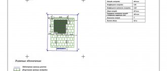
Construction of a house begins with drawing up a master plan for the land plot. The start of laying utility lines must be based on a package of permits, which includes a general plan. To draw it up correctly, take into account the properties of the terrain, the location of all buildings, fire safety requirements and coordinate this document with the BTI, administration and architectural department.
Example of a general plan of a land plot
What is the essence of the master plan
Russian Government Decree No. 87 dated February 16, 2008 states that this is a document containing land planning, site development, as well as any work that will be carried out on the site during construction. A document is prepared by superimposing a drawing of the future object on a topographic (photographic) base at a scale of 1:2000, 1:500, 1:200. The master plan can be drawn up for both an individual building and a microdistrict. The approved set of drawings of the plan being developed must have:
1. General information about working sketches.
2. Cadastral plan with plot dimensions.
3. Relief diagram.
4. Sectional drawing with soil layers.
General plan of the site in Moscow
5. Drawings of utilities - water supply, gas mains, electrical wiring diagram for the house, sewer system, etc.
6. Documentation for landscaping a personal plot.
7. Remote fragments – neighboring objects, roadways and other structures located nearby.
The registration requirements are the same throughout the Russian Federation. They operate both in Moscow and anywhere else in the country.
How much does design work cost?
The costs of designing a general plan for a site or a house directly depend on the detail of the development of drawings, the number of approvals and stages of work, the complexity of research work, engineering calculations, and the chosen construction technology. The average cost of developing a general site development plan is >2000 rubles. Each additional copy to the technical construction design diagrams >1000 rubles. The cost of house projects is determined per square meter of building area:
- architectural and construction project >350 rubles;
- separate heating, other communications >100 rubles;
- construction estimate >100 rubles;
- visualization on the screen without camera movement 50-65 rub.
A competent, high-quality project of a house master plan will allow the developer to get a real opportunity to create comfortable housing without additional problems and with a well-thought-out external and internal infrastructure.
Purpose of the document
A master plan is necessary for two reasons:
- Its preparation is a mandatory legal requirement, and without completed documentation, construction cannot begin. Compliance with established standards guarantees the safe operation of the building. Therefore, the master plan of a private house contains fire safety and sanitary requirements. Thus, in accordance with established standards, the gap between the walls of a residential building and the road should be 5 m, and the width of the canvas should be 3.5 m. Such requirements guarantee the free movement of equipment or fire trucks.
- Sketches and descriptions of work are a guide for construction. A properly designed project distributes buildings and auxiliary facilities throughout the yard. This is a complex that includes a residential building, a garage, a garden or vegetable garden, a swimming pool and/or bathhouse, etc. Therefore, when ordering even a standard project, you can propose your own changes.
Explanation of boundary approval
Advice: It is better to formulate a master plan for the land plot in parallel with the house design in order to provide for all the features of the area being built up.
Documentation for the planning of a future cottage (or other residential building) is coordinated with the architectural authority of the corresponding locality and its existing plan for the entire territory. To resolve any controversial issues, you must contact the administration.
Reasons for refusal to issue a general plan
Despite the fact that the main planning work is carried out by the committee's specialists, the applicant may be denied the service. Causes:
- The execution of the documents provided does not comply with the requirements of the legislation of the Russian Federation or they are invalid.
- The package of official papers is incomplete.
- The person who applied is not the owner of the land, or there is other false information.
- When submitting an application through the website, the fields were filled in incorrectly.
- Copies submitted electronically are of very low quality (unreadable).
- There are unauthorized buildings on the territory.
- There is a contradiction between the municipality’s decision to divide the territories and the location of the plot.
If a refusal is received, it is recommended to correct any errors found, obtain current documents, and resubmit the completed package. Another option is to appeal the decision of the government agency. The same can be done if the issuance of a general plan is delayed without good reason.
Consistent design of the master plan
The beginning of the compilation consists of collecting documents:
- House layout approved by the locality architecture service.
- Site drawing.
- The results of geological surveys, topographic and geodetic surveys - a general plan drawn up on a scale of 1:500.
- Requirements for connecting housing to centralized communications.
Minimum permissible distances between objects
Formation of the document is carried out step by step:
1. Deciding on specific buildings. At this stage, a list of objects is compiled, with their dimensions determined and the distance to the fence (or neighbors’ houses). Next, for each specified building, it is necessary to register, taking into account what sanitary standards its construction will be carried out.
2. Drawing of the appropriate scale: 1:500 or 1:20,000. The display size is selected based on the underlying basis used: situational, general or reference plan. The designed communications and relief characteristics are brought into compliance.
3. Making a decision on the placement of buildings on the territory.
Important: It is necessary to take into account slopes and dips in the terrain, normalized distances between objects.
Formation of a dendrological plan of the site and a drawing indicating other elements.
5. Making final adjustments as per the requirements of the home owner. After final approval, all the details are recorded on paper.
Can a developer violate (cancel) the general plan?
Upon completion of all approvals and lengthy public hearings, the master plan is finally approved. Once an act has been adopted, it cannot be canceled! Making such an attempt is tantamount to drawing up a new plan and waiting for its approval.
Changes to the master plan can only be carried out in court. But, as practice shows, the court more often sides with the village residents. First of all, public interests are supported, not just one person.
Documents for the formation of a master plan
The following are used as the basis for its preparation:
- cadastral plan of land for future buildings. On such a diagram, the boundaries of the site are defined and there is a graphical representation of it;
Graphic display of the area
- a description of each of the possible buildings erected;
- a diagram showing all objects in the adjacent territory, the roadway;
- situational plan. This is a site location map. The name of the locality, region and country must be indicated here. It looks like a photo from space;
- reference plan. This is a kind of diagram indicating all construction projects in the yard, green spaces;
- drawing of utilities: sewerage, electrical connections, gas pipeline, water main, indicating the points of entry into the building;
- diagram of preparatory operations on the site with highlighting elevations.
Sample situation plan
What is a master plan and why is it needed?
The master plan of the village is the main document of the developer of suburban real estate. It consists of many maps and an explanatory (text) part. The maps show the prospects for the development of the territory of the command post, what it will look like in a few years.
The difference with regular maps is that they depict not a specific object, but a functional area. It determines for what functions this or that territory of the village will be intended.
Examples of functional areas:
- shopping – markets, shopping centers, supermarkets;
- industrial - various small workshops, service stations and others;
- recreational – parks, beaches, recreation centers;
- entertainment - children's play centers, attractions, cinemas;
- residential - for the construction of a residential sector;
- public and business – banks, medical centers and public utility facilities, kindergartens.
According to the approved GP, by law, in each zone only objects that correspond to its purpose can be built. In addition, it stipulates the preservation of ecology and environmental protection.
After reading this document, the buyer will decide how suitable the future infrastructure is for him, whether to stop choosing or look for a more acceptable option.
For what purposes is a master plan drawn up?
All large and small settlements must have a general plan. Its main tasks:
- prevent conflicts in the field of architecture and urban planning;
- combating unauthorized development and unauthorized construction;
- harmonious development of human settlements;
- prevention of traffic jams, shortage of kindergartens, schools and other social services.
All these problems negatively affect the lives of people in populated areas. Master plan - solves all problems before they arise, if the developer adheres to it in all details.
Nuances during formation
Please note that:
- You cannot plant tall trees and build houses where communications are located;
- if the soil is prone to waterlogging, the area should be provided with a drainage system;
- on uneven terrain, it is better to build buildings at some elevation;
- When building a house on a slope with a slope angle of ≥ 1:2, it is recommended to strengthen the soil with supports, and also to plant trees with a deep root system nearby.
Basic rules taken into account when drawing up a development map
When forming a plan diagram, the permissible distances between objects - a residential building, fencing, utilities, neighboring houses, etc. are taken into account. Basic rules that specialists take into account when drawing up a document:
- Engineering communications are the basis for determining the location of capital construction. Where water pipes and other underground and above-ground pipelines pass, the construction of residential buildings and the planting of tall trees are prohibited.
- If the terrain is uneven, it is better to build a house on a hill, because... otherwise, it may be flooded during spring floods. Construction on very steep slopes without special retaining walls is not allowed.
- The distance between the cottage and the street fence should not be less than five meters. Between adjacent areas it is allowed to reduce the distance to three meters.
Sample master plan
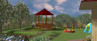
The figure shows a standard example of developing a personal plot on a scale of 1:500. Structures and plants are indicated here, details of the terrain, sidewalks and garden paths, entrances for vehicles, etc. are reflected. The more details and details there are, the easier it is to carry out further work.
Although the cost of the document is high, it is mandatory to have it. Otherwise, the entire process will subsequently be declared illegal by the urban planning department.
Why us?
- We have been making master plans of varying complexity since 2006, the minimum professional experience of our specialists is 10 years.
- All employees have specialized education and the highest qualifications in their specialty.
- Clear knowledge of the legally regulated theoretical basis for the location of residential buildings.
- Individual approach to each customer, free consultations, we take into account all wishes and nuances.
- We work without intermediaries - no overpayments or markups, the best cost of services on the market.
What it is?
A land plot plan is a document that contains information about the land plots being formed, their parts, as well as new ones necessary for inclusion in the cadastre.
This is a drawing in which a certain territory is depicted in a reduced form using a scale. Such a drawing is the main cadastral document, which is formed during the land surveying process and is necessary to clarify the boundaries. It most often contains all the necessary information, including reference to the area and surrounding objects, both natural and built by man.
What is the difference?
The land plot plan has its own characteristics compared to other types of documentation. These differences must be understood and seen in order to understand the technical documentation for real estate objects.
From the layout
A territory planning project is a type of documentation that is adopted on the basis of the general plan and land use and development rules. A planning project is necessary to highlight zones of the planning structure and is usually developed for large structures.
Compared to a planning project, a plan has a higher level of detail in information. The boundaries are highlighted on the plan:
- private estates;
- local areas;
- public lands.
From the layout
The main difference between the situational plan and the layout diagram of energy receiving devices is the signature of the performing surveyor, which must necessarily be on the layout diagram.
It will be necessary to conduct a topographic survey without installing underground utilities.
Building base
The next tool on the Forms and General Plan command bar is Building Base . In the “Drawing” section, you can use any of the proposed tools to create a sketch. It is important to note that the base is created with the slab already in place, and the toposurface is adjusted to the contours of the slab.
Stages of developing a house project
An individual house project involves interaction with the customer at every stage. The first meeting usually takes place in person, as many points need to be discussed. Subsequent interaction is carried out in person or remotely, via email or instant messengers. After approval of the sketch, sections of the working documentation AR (architectural solutions) and KR (constructive solutions) are developed almost in parallel. Architects, designers and engineers coordinate all decisions among themselves. Such close cooperation allows us to avoid unpleasant “surprises” during construction.
Stage 1. Consultation, filling out a design assignment
Stage 1. Consultation, filling out a design assignment
At the first meeting, the architect draws up a technical specification.
It reflects all the customer’s wishes for the future home - number of floors, architecture, layout, and determines the approximate construction budget. For your reference, we will show examples of finished projects. The architect provides information about conditions, prices, and design deadlines. When all points are discussed and agreed upon, a contract is concluded. We conduct consultations at a time convenient for clients. We draw up technical specifications using a checklist. This saves time and prevents you from missing anything. After the conclusion of the contract, the price, as well as the design time frame, will not change.
ARCHITECT CONSULTATION
Stage 2. Visit to the site, measurements
Stage 2. Visit to the site, measurements
An architect and an engineer go to the site to take measurements and assess the terrain.
Measurement documentation is drawn up. This is necessary for the correct positioning of the house. At this stage, the customer is recommended to collect data about the site. These are technical conditions for connecting to communications, topographic surveys, and geotechnical surveys. Also, you should not start building and designing houses without an urban planning plan for the site. We provide free travel within the Moscow Ring Road at a time convenient for the customer. If necessary, we will help you perform the geology of the site, topographic survey, and obtain technical specifications and GPZU data.
FREE DEPARTURE
Stage 3. Development of the draft part of the project
Stage 3. Development of the draft part of the project
The architect prepares several preliminary sketches to choose from.
The most successful one is adjusted, a preliminary design is developed, as well as 3D visualization. At this stage, you can see what the housing will look like - facades in color, volume, roof architecture, layout. The layout of the house on the site (general plan) becomes clear, and the approximate cost of construction is determined. The architect will take into account all the client’s wishes. The specialist will select modern, comfortable solutions within the budget.
ORDER A SKETCH DESIGN
Stage 4. Development of the architectural part of the project: AR
Stage 4. Development of the architectural part of the project: AR
Architectural design gives specifics.
Materials, exact dimensions and heights of windows and doors are determined, a roof plan, vertical sections, facades, explications of floors, walls, roofs, drawings of non-standard components and parts are developed. Note that according to the legislation of the Russian Federation, the architectural part of the project is mandatory to obtain a construction permit. We do not inflate estimates, we try to save the customer’s finances through rational design. Modern materials and construction technologies make it possible to simplify and reduce the cost of some aspects.
ORDER DESIGN
Stage 5. Development of the design part of the project: KR
Stage 5. Development of the design part of the project: KR
At this stage of designing houses and cottages, the architect’s decisions are supported by design calculations.
The house is given strength and durability. In the design section (KS), the optimal parameters of the foundation, floors, rafter system, and other load-bearing elements are calculated, taking into account loads, climatic conditions, and geology. After this, the amount of materials is calculated and a construction estimate is prepared. We develop informative, understandable drawings and plans. Construction will be easy using them, as per the instructions. We carry out design in modern three-dimensional programs, due to which the project is prepared faster, without accidental errors.
ORDER DESIGN
Stage 6. Development of engineering parts of the project: EO, OV, VK
Stage 6. Development of engineering parts of the project: EO, OV, VK
Engineers develop electrical, lighting, heating, water supply, and sewage systems.
We carry out design taking into account energy efficiency requirements in order to reduce the cost of maintaining the cottage. If necessary, engineering sections can be developed during the construction of the house box. But it is better to do them in advance, since it is more convenient to arrange communications at the “zero cycle” stage. WE INVITE YOU TO A CONSULTATION
During the meeting with architects and designers, you will receive answers to all questions regarding the pros and cons of modern house construction technologies, see and study the complete design documentation for the construction of a cottage
Order
Where to apply, terms and cost
When the entire package of documents has been collected, you need to contact the Committee on Architecture and Urban Planning. There you fill out an application according to the sample, and also submit all documents.
In each case, the period for drawing up a plan takes a different amount of time. When contacting a private organization, the work will be completed much faster.
If the application was submitted to a government agency, then the entire process will be free for the owner. A private organization will require payment for this, however, as mentioned earlier, they will do the general plan much faster and, possibly, of better quality.
