A diagram of the situational plan with reference to the area is ordered along with a copy to provide information about the site in the event of its sale, as well as for connecting electrical and gas networks.
For a plot of up to 15 acres
Price from: 12,000 rub.
The price is valid until December 10
Call me back Calculate cost
What is a situation plan for the location of an object?
The designation on a map of the area of a land plot with highlighted boundaries, buildings located on it, communications, and adjacent neighboring territory is called a “situational plan.” According to the rules, all construction projects on it are accompanied by information about the date of construction, number of storeys, street names, and house numbering are indicated.
Wikipedia states that a situational plan is a contour plan that does not contain information about the terrain of the territory. In other words, it uses horizontal surveying to create it, as opposed to a topographic geobase, which includes displaying elevations. In addition, the application of various objects is carried out using conventional signs that are understandable to users without an engineering education.
Ready turnkey situation plan
Order
Self-composition
If a person does not have time to wait a month for the application to be processed, he can try to make a plan on his own.
To do this, you need to draw the boundaries of the area on graph paper or just squared paper , observing a certain scale. On the site, paint all existing objects, including unfinished ones - a house, barn, well, etc. Next, paint all neighboring objects - houses, plots, roads, etc.
Before putting all the data on the plan, you need to take appropriate measurements in order to correctly put them on paper and maintain accuracy. To begin with, you can try to draw a draft, then clarify all the measurements again and transfer them to the finished version.
In addition to objects located on the territory and nearby objects, you need to record the cardinal directions on the map, it is advisable to indicate the wind rose. Such a plan can subsequently help the owner correctly plan the placement of windows in the house, determine a recreation area, plant various plants, plan landscape design and much more.
A situational plan made independently has one significant drawback - it will not be able to accurately show the passage of communication lines on the site and nearby streets. This will prevent it from being used as a basis for planning or construction.
When is it necessary?
To conduct a transaction of purchase/sale or lease of a property from the legal side, the situation plan is not a mandatory document.
Its presence is necessary to provide complete information about the boundaries of the site, the adjacent territory, nearby favorable and unfavorable areas, security zones, etc.
You will also need to order a situation plan in the following cases:
- obtaining permission to design and build a new facility;
- carrying out reconstruction of historical buildings, monuments;
- gasification, electrification of the site.
Appeal procedure
There are often cases when representatives of local authorities exceed their powers and, for far-fetched reasons, refuse to accept documents for consideration or hand over the result to the applicant.
For such cases, there are certain regulations for appealing decisions of local governments, both in court and in pre-trial proceedings.
A pre-trial complaint can be filed:
- If the deadline for registering an application for the provision of a plan is missed;
- If the deadline for submitting the plan is missed;
- If representatives of the municipality require documents from the applicant that are not provided for by regulations;
- If the applicant is refused acceptance of the application;
- Refusal to issue a plan without legal basis;
- Demands are made to pay for a service not provided for by the relevant acts;
- In case of refusal to correct errors made or violation of the deadline for their correction.
The complaint must be sent to the local administration in writing, via the MFC or the Internet. How to correct a cadastral error in a boundary plan - read here.
Situation plan by cadastral number online
After cadastral numbers began to be assigned to all real estate objects in 2007, transactions with them are only possible if this identifier is available. The number is issued once and is assigned to the site, regardless of the change of owner.
All information is stored in the Rosreestr database and is freely available to users, which, in turn, makes it possible to obtain a situational plan of a land plot using the cadastral number.
The package of documents for issuing a site situation plan at the MFC branch includes:
- application on a standard form;
- real estate documents confirming ownership, or an extract from the Unified State Register of Real Estate;
- identification documents.
Public cadastral map of Russia on
Therefore, there are 4 possible reasons why the site is not on the map:
- no surveying was done at all
- surveying was done a long time ago (before 2006)
- surveying was done recently (1-2 months ago)
- technical errors when registering a boundary plan
Read more in our article. The map shows only areas for which land surveying has been done (that is, the exact coordinates of the corners have been measured).
no land surveying was done at all.
Share a link to the map (read more...)
On the public cadastral map you can find any land plot or capital construction project that has been cadastrally registered in the Unified State Register of Real Estate and for which a land surveying procedure has been carried out.
Plan for gasification
When agreeing with the operational services for connecting the site to the gas network, a mandatory package of documents is drawn up, which includes a situation plan with reference to local coordinates, drawn up on an A4 sheet. Information on the possibility of preparing a situational plan for gasification is provided by the local municipality.
To obtain a situational plan of a land plot by address, it is enough to indicate the exact coordinates of the location of the object.
In the absence of such information, it is necessary to contact a specialized organization that will produce a situational plan of the land plot on a scale of 1:2000 after performing a topographic survey for gas.
It is also possible to prepare the document yourself. The basis is taken from high-resolution maps from open sources. Before this, it is necessary to notify the operational services in advance about independently drawing up a situational plan for the land plot for gasification.
Cost and terms of receipt
The cost of preparing a joint venture may vary significantly depending on which organization the applicant contacts to draw it up. If you contact a government organization, no payment will be charged for such an action. If an individual or legal entity decides to use a private company, the amount of payment will depend on the following factors:
- The region of location of the company providing such services - throughout the Russian Federation, the cost of such services may vary significantly;
- Organization's prices - each company has the right to set its own prices for the provision of services for the implementation of the joint venture;
- The amount of work that needs to be done when drawing up a plan.
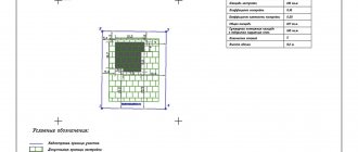
Sample plan with symbols
When applying to a government organization, there is a certain period during which, after acceptance of the application, all necessary work on drawing up the plan must be completed.
This period consists of two parts - during the first 30 days, the application is reviewed and the possibility of forming a plan is determined; if such an action is not possible for certain reasons, the applicant is given a refusal, which will be reflected in the official notification, which is sent within 1 day from the date making a decision.
If a decision is made on the possibility of drawing up a plan, then within three days it will be drawn up and provided to the applicant.
Ground plan for electrical grid
An application to connect a site to the electrical network must be accompanied by a plan for the location of power receiving devices. The document contains two parts: text and graphic. The latter is a map-scheme M1:500 on an A4 sheet.
When drawing up a situational plan for electrical networks, you must indicate:
- clear boundaries of the site;
- main and secondary buildings;
- ground and hidden utility lines;
- power lines with external power supply;
- cable markings, protective equipment, grounding points.
You can obtain a plan for the location of energy receiving devices by cadastral number from the Rosreestr database.
Turnkey electrical plan
Order
Step by step guide:
- To do this, you need to register on the site and send the appropriate request.
- Next, the resulting situational diagram must be scaled to 1:500 and saved electronically or printed.
- Then find a sample situational plan for connecting electricity and, using a graphic editor, identify nodes and power lines on the site.
But it is worth noting that municipal energy service workers may not accept such an EPU plan for connecting power grids.
You can order the production of a document from organizations providing geodetic services. Specialists will take measurements, draw a diagram of the location of the control unit and compile a descriptive section.
SPZU “with reference to territory”
In addition to the topographical plan, explanations and links are provided that reflect the most complete information. If the SPZU is being prepared for gasification or installation of power lines on the site, an additional service will be required - connection to the territory.
In this case, the diagrams of objects are permeated with signs that determine the passage of power lines:
- linear objects;
- wiring in an existing building, private house;
- underground cables, etc.
Their exact location is indicated and their connection to the corresponding power systems is explained. The same is prepared when gasifying a site or building area.
This work requires the most accurate indication of the location parameters of the specified objects. Therefore, a whole network of symbols is built on the plan, penetrating the schematic, capital and other buildings.
Where can I download it for free?
Sometimes the legislation of local municipalities allows for the independent preparation of a situational plan according to the cadastral number. You can download the document from the Rosreestr database or compile it using maps from Yandex and Google services. Certain requirements are put forward for such a situational plan:
- presence of all necessary symbols;
- compliance with a given scale;
- supporting the data shown in the diagram with an explanatory note.
The difference between a situational plan and a general plan is that it contains relevant information at the time of preparation. In addition, the diagram is drawn up on a scale of 1:500, 1:2000, 1:5000. The master plan is prepared on a scale of 1:200, 1:500.
Where can I order a situation plan by address?
The architectural department is preparing a situational plan for a site in the Moscow region. In Moscow, issuance is carried out by Mosgorgeotrest.
You are required to print out a land plot plan by cadastral number free of charge within 3 days after applying.
It is worth considering that information in government databases may be outdated, and you will have to independently enter current information into the document.
In particular, this applies to real estate in the Moscow region. The situational plan of the site in Moscow may contain more up-to-date information due to frequent database updates.
Refusal
Cases of a negative decision are rare. There are three possible reasons for refusal:
- the information provided by the applicant has not been verified for authenticity;
- the area for which the situation plan was requested is located in the jurisdiction of another region;
- the package of required documents is incomplete.
The reason for the refusal will be stated. The missing papers should be collected, everything should be double-checked, and you should apply again. In case of refusal without specifying reasons, a person has the right to go with a complaint to higher authorities.