The terrain does not always allow you to build a reliable house without making adjustments to the natural landscape.
Sharp slopes threaten flooding, washing out of fertile soil, and destruction of the house.
To adapt the territory for comfortable living, a vertical layout of the land plot is used before construction.
Why do they change a flat surface, who carries out geodetic work, is it possible to calculate the differences in the ground yourself - read about the intricacies of vertical design in this article.
What it is?
Vertical layout (VP) of a land plot - preparation for artificial transformation of the natural terrain , preparatory stage of construction.
Work begins with geodetic measures to determine the coordinates and heights of surface points and spatial objects. Sometimes it is enough just to determine the actual height difference.
Based on the research results, it is concluded how much the surface is deviated from the ideal horizontal.
At the next stage, it is assessed how high the groundwater lies and how much the soil swells from low temperatures.
Before vertical planning, preparatory work is completed, unnecessary soil and vegetation layer, trees and shrubs are removed.
Planning objectives are to optimally adapt the land for construction and living :
- level the terrain;
- highlight zones with slopes;
- determine places for arranging slopes, stairs, terraces;
- reduce the groundwater level, create effective drainage;
- provide optimal conditions for plants;
- combine the zones of the site with a single architectural and stylistic idea;
- outline the lines for laying underground communications.
Artificial relief is created during excavation work: softening slopes, cutting or adding soil, constructing local embankments.
Content
- Preparing the site for construction
- Construction
- Planning of the territory of the land plot. Results.
First of all, you need to draw at least a rough plan of your site. It doesn’t look very nice if you have a house and outbuildings right next to the road, and somewhere in the depths of the plot there is a vegetable garden or orchard hidden.
If you decide that this issue needs to be approached thoroughly, then start first by studying SNiPs and GOSTs. Yes, exactly from them.
The algorithm of actions will look like this:
- draft plan of the land plot for construction;
- thorough study of SNiPs and GOSTs:
- preparing the site for construction;
- construction;
- planning of the landscape part of the site.
But let’s start, perhaps, we won’t bore you.
Planning principles
Vertical planning is carried out taking into account the preservation of the natural environment :
- maximum preservation of natural relief, soil and existing flora;
- drainage of surface water at a rate that prevents soil erosion;
- minimum excavation work using excavated soil at the construction site.
Other principles of correct EP that guide the developer when carrying out upcoming excavation work:
- Saving . VP is a costly undertaking that requires the involvement of surveyors, engineers, and rental of special equipment. To avoid unnecessary expenses, follow a well-thought-out plan, with minimal use of natural and technical resources.
- Maintaining a balance of earth masses . His rule: the volume of the withdrawn land mass should practically correspond to the volume of bedding on the site being developed.
- Individual approach . When VP, averaging and standard solutions cannot be used - in addition to the wishes of the owner, the features of a specific landscape are taken into account.
Video description
The video shows the full range of services: backfilling the site, forming storm and drainage sewers:
Height of the basement part of the foundation
This parameter is calculated taking into account the height of the snow cover. In the main part of Russia it does not exceed 70 cm, in the northern regions its size is more than 1 m. It turns out that the height of the base is the height of the snow cover, plus 10-20 cm.
The reason for this calculation is that in the spring, when the snow begins to melt, moisture negatively affects the wall structures. Wet structures are exposed to the negative effects of water, which can penetrate into the interior of the house. But the exterior decoration suffers the most from this.
It is necessary to understand that in many houses built on a slope, the basement is used for service purposes, and even for living rooms
Therefore, it is very important to correctly carry out waterproofing measures both outside and inside the basement. And also organize efficient ventilation
The height of the base is incorrectly selected Source otlivhouse.ru
Regulations
When designing and constructing residential buildings, they are guided by the standards SP 55.13330.2016 “Single-apartment residential buildings.” The construction of cottages is carried out in accordance with the requirements of “Planning and development of the territory of gardening by citizens. Buildings and constructions".
Development of design documentation for private development is carried out on the basis of SP 11-111-99. In addition, during the construction of objects they rely on the Land and Town Planning Codes of the Russian Federation, as well as other sets of rules (SP) :
SP 45.13330.2017 “Earth structures, foundations and foundations”;- SP 42.13330.2016 “Code of rules. Urban planning";
- SP 82.13330.2016 “Improvement of territories”;
- SP 126.13330.2017 “Geodetic work in construction”;
- SP 47.13330.2016 “Engineering surveys for construction.”
Design Goals
Before starting construction, the natural deficiencies of the area are compensated. With vertical design, the natural terrain is transformed into an artificial one, which best meets the requirements for the operation of the house and landscaping of the site.
When performing the VP, the foundations are laid for the correct planting and long-term operation of the house :
- Pits and trenches are formed for foundation structures.
- The bearing capacity of the soil at the base of the foundation increases.
- The severity of frosty rising of the ground decreases.
- Optimal conditions are created for drainage and removal of water from the foundation area: groundwater, melt, and rain.
Proper planning eliminates the visual effect of a “house in a hole.”
When carrying out excavation work to level a construction site using the bedding method:
- the permissible load on the foundation increases;
- the number of freezing layers is reduced;
- the thickness of the soil above the groundwater boundary increases;
- the impact of soil movements on the foundation under the influence of negative temperatures is reduced;
- the evacuation of rain and melt water from the construction site is improved.
Soil from pits and trenches is used for backfilling, so there is no need to remove it, spend money on disposal, or look for alternative methods of use.
Is it possible to get by?
If during the construction of a house VP was not carried out, or was carried out unprofessionally, the consequences can be disastrous :
- The house tilts with gradual destruction. If the site is not leveled, the load on the foundation will be distributed unevenly, which will lead to cracks, structural instability, and collapse.
- Inability to maintain a garden. Flooding that is difficult to predict is destructive to soil and crops.
- Problems of engineering communications. The eroded soil will cause damage to electrical networks, sewerage systems, and wastewater treatment plants.
- Impossibility of building a ground floor and basement: there is a high risk of flooding and collapse in the event of eroded soil movement.
- Rotting of wooden buildings under the influence of increased levels of precipitation.
Due to the washing out of the soil and the instability of the site, it becomes impossible to build light buildings: gazebos, bathhouses and sheds.
What kind of memory is absolutely necessary?
Uneven landscapes limit the developer: not all projects are suitable for implementation; the construction of a pile foundation may be required. In addition, uneven areas are susceptible to soil erosion by rain and melted snow.
Based on the relief factor and elevation changes within the boundaries of the development area, the land plots are classified as:
- smooth;
- with a slight slope: ≤0.5 m;
- with a significant slope: 0.5-1 m;
- with a steep slope: ≥1m.
Experienced builders believe that every site needs bedding: even flat areas should be raised to lower the groundwater level.
Atmospheric precipitation removal
As mentioned above, for this you will have to build a blind area and lay a drainage system.
As for the first, for this purpose, a backfill of durable soil or a mixture of sand and crushed stone 10 cm high is made around the entire perimeter of the house. That is, it is necessary to begin the construction of a winding on a site that will be higher than the plane of the main soil.
The width of the blind area is 80 cm, the angle of inclination away from the foundation is 5°. Usually it is filled with concrete mortar, but you can use asphalt or piece slab products (stone or concrete), which are laid without gaps. The main requirement for the blind area is one hundred percent water impermeability. If the soil in a suburban area is heaving, then the blind area is filled not with a single strip, but in sections with length dimensions ranging from 1.5-2.5 m.
Blind areas of a house built on an uneven plot Source www.remontnik.ru
As for the storm sewer system, first of all it is necessary to understand that before construction began, melt and rain water flowed down the elephant without encountering any obstacles on its way. The erected house on the mountain side is a huge insurmountable obstacle. Therefore, it is in this place that water will accumulate. It must be diverted skillfully, for which they use trays installed along the foundation located on the upland part of the slope, with a slight slope away from the house, but along it.
Now about deep drainage. It is constructed only if the soil on the site is sandy, but below it there is dense clay soil that does not allow water to pass through. During the rainy season, water passes through the sand, but does not penetrate the clay. An aquifer is formed, which is called perch. It is very dangerous for the foundation. Therefore, at the level of the high water, drainage pipes are laid, with the help of which water is drained.
How to do VP - stages
A land survey is carried out before construction begins in order to prepare the landscape for future development. First, pre-design work is carried out.
Geodetic topographic survey
Mandatory stage , from which the development of schemes and planning of earthworks begin.
The terrain is leveled: the height and depth of landscape elements are determined relative to the conditional zero mark. The survey is carried out by specialists using geodetic equipment. After determining the altitude position of the design surfaces of the site, the optimal option for excavation work is selected.
Geological research
At the stage of geological surveys,:
- type of soil, its characteristics;
- the level of groundwater that is dangerous for the technical condition of the future foundation;
- soil freezing indicator;
- degree of frost heaving of the soil.
Geodetic and geological information is used in the development of design plans and diagrams.
Project development
The preparation of project documentation is carried out in stages:
- Collection of information . Studying the features of the relief according to the documentation received at the stage of pre-project preparation. The assessment is carried out on the basis of a detailed topographic plan, survey of relief elevations, results of studies of the structure and composition of the soil, information about the depth of groundwater and soil freezing. If necessary, additional measurements are taken.
- Development of a planning scheme in design marks. Survey data from real and design high-altitude points and the horizontal contours of the actual relief are plotted on the topographic plan.
- Drawing up a plan for transforming the relief in design contours. The designation of lines of real and projected relief configurations is carried out using the contour method: the existing one is drawn in black, the projected one is highlighted in red. The finished plan reflects a clear picture of the upcoming soil movement activities.
- Formation of a cartogram of the movement of earth masses. The cartogram indicates the marks of the design heights and the existing relief, and identifies the zones of excavation and fill of soil.
Based on these documents, a vertical layout project is being developed.
Planning of the territory of a linear facility
In this case, the project is drawn up in approximately the same way. Its main part includes drawings with the boundaries of the administrative structures on the territory of which the linear facility will be laid, with the designation of transport networks, power lines, etc. It is accompanied by materials justifying the construction, in the form of text and graphic documents.
How to make a diagram?
Land plots for construction, regardless of the topography, require accurate calculations and diagrams.
On a geodetic basis:
- indicate the location of objects;
- The design surface is marked with red lines.
Lines formed by the intersection of the base with other planes are projected onto the plane by horizontals.
The pitch is 100-500 mm, depending on the scale, conditions and complexity of the arrangement. You cannot cut off the horizontal lines; they must go through the entire plan, and the section remains unchanged. An acceptable case of contour breakage is the connection of design surfaces with slopes, walls, and fences.
If it is planned to add soil, the red lines are moved back, indicating a decrease. The area where land acquisition is planned will be elevated in the diagram.
The slope, which is constant throughout its entire length, is reflected by the equal distance of the horizontal lines from each other. The angle between the lines, indicating the marks of low terrain, indicates the ridge; in the opposite case - to the notch.
Surface water will be drained at right angles to the red lines. Horizontal lines with a closed concentric contour surrounding one another are indicated by :
- hill - the center is occupied by higher lines;
- depression - closer to the middle the lines decrease.
This information is enough to read and implement the vertical planning scheme.
Means, tools, equipment
To measure differences in memory and markings you will need:
- level;
- building level;
- roulette.
Geodetic work is carried out only by professionals with special equipment. Site planning (filling, cutting, moving, loosening the soil) is carried out mechanically or manually.
In the first case, heavy special equipment :
- bulldozer or grader;
- tractor with cultivator or bucket.
When working independently, a walk-behind tractor with a cultivator and a cutter for cutting soil is used.
Needed for manual work:
- shovels;
- choppers;
- rake;
- scrap;
- pegs;
- sledgehammer or hammer.
To remove trees and bushes from the area, an ax, saw, and hacksaw will be useful. To transport soil you will need a wheelbarrow.
Tips for different terrains
It is advisable to place the house in the highest part of the site. In order for the foundation to be above groundwater, methods without deepening (or with minimal) are used.
Sometimes technical issues hinder such methods: a heavy structure is designed, a movable top layer. In these cases, an optimal compromise solution is selected - and only with the involvement of specialists.
Then a blind area is performed, and trays are installed to remove surface water. A well-thought-out topography should drain precipitation and melt water into a water intake: a ditch, a reservoir . Groundwater is drained from the site using deep drains into drainage wells.
If the house is located on a hillside, the terracing method is used - creating several levels (steps) based on the principle of a staircase. When constructing terraces, soil is added, slopes are strengthened, and retaining elements are installed. The terraces look beautiful, effectively remove moisture, and on each of the “steps” you can arrange a small garden. Terracing has one significant disadvantage - the high cost of the work.
Relief is an important component of the landscape. Its features determine the planning and compositional solution of the object. With flat terrain, landscape designers recommend adding expressiveness to the overall composition. Artificial microrelief is created by slides, retaining walls, and dumps.
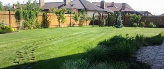
Flat territory
Often, flat areas are located in lowlands, where high groundwater levels, accumulation of rainwater and melted snow cause rapid waterlogging. Before construction, a low embankment is made and a shallow foundation is laid. The thickness of the soil backfill is 20-50 cm.
Soil (soil with plant and other organic elements) cannot be used; clean, dense material is needed.
The poured area around the perimeter is compacted with a sand-gravel mixture.
An example of a flat area in the diagram below:
- Blind area. Width 1 m, slope 3 cm/m. A greater slope is not recommended: the blind area will be uncomfortable for walking, and in winter – slippery and dangerous. For comfortable movement, internal corners are cut at an angle of 450.
- Water dispersal area. Width 2 m, slope 2 cm/m. If you form a larger slope, the fertile layer will be washed away.
- Slope area for water drainage. Width 5 m, slope 1 cm/m.
- Water discharge area. Slope 1-5 cm/m.
With a slope
If the height difference within the boundaries of the future foundation does not exceed a meter, fills are made for leveling. In this case, the soles of the base lobes should be on the same line horizontally (with a slight deviation).
No more than 0.4 m
If the slope is less than 0.41 m, the entire site is leveled to a horizontal level. The above-ground portion of the plinths is located at the same height.
From 0.4 to 1 m
When the difference in height of the natural relief is more than 0.40, but less than 1 m, new portions of soil are not poured into the horizon, limiting themselves to artificially lowering the unevenness.
Over 1 m
A basement is being designed on a site with such unevenness. Drainage is installed on the ground floor. Not every developer is able to carry out proper planning in such non-standard conditions; it is better to turn to professionals. They will diagnose the area, study the composition of the soil and the depth of groundwater.
Nuances by geographical location
It is important to consider the following points:
If the landscape is flat, the location of the house and green spaces requires minimal financial and time costs.
As a rule, slight slopes are arranged near the walls to drain water to the boundaries of the site. Slopes are formed using a soil embankment.- Areas sloping south are characterized by oversaturation of vegetation. Such reliefs are ideal for arranging green areas. The ideal place to build a house is considered to be the highest point closer to the eastern border of the site.
- Areas where the terrain slopes towards the east and west have their own characteristics. It is better to locate buildings near the northern borders to avoid shadows on plants.
- Areas with a steep slope to the north require a reliable drainage system.
Layout of a summer cottage plot of a country house - rules and design options
Happy owners of suburban plots and owners who have just acquired their rights to use the land are faced with many nuances: starting from the location of the house, buildings and ending with the elementary planting of fruit trees. Careful planning of a dacha plot will help prevent mistakes that arise when making hasty decisions and ensure efficient use of the entire territory of the plot.
Basic principles of site planning
The layout of the site of a country house depends primarily on the nature of the relief, the shape of the land section, neighboring buildings and other local features. Important factors are the location of the site: elevation or lowland, the presence of water sources, location on the site of a former forest or steppe.
A well-planned space will allow you to accommodate all the owner’s ideas even in a small area: a cozy home, arranging a swimming pool or bathhouse, a quiet corner for relaxation, a luxurious garden with fruit crops
The layout of a garden plot, which will delight the owners with the lush flowering of crops and active fruiting, requires taking into account the ground level, which may subsequently affect the direction of the flow of rain or melt water.
To develop a summer cottage, local removal or addition of soil, arrangement of blind areas near the walls of buildings, and organization of drains may be required.
To strengthen the slopes, you can use special structures: terraces and slopes, retaining walls and stairs
The vertical layout of the site will make it possible to maximally adapt the existing terrain for the growth of valuable crops, as well as protect the foundations of buildings from rain and flood waters.
The key to successful site planning is also taking into account the sides of the horizon. This will make it possible to rationally place all plantings and buildings, taking into account solar illumination at different times of the day and year.
It is preferable to place buildings and large trees on the north side so that their shadow does not fall on green spaces. In addition, the facade of the house located on the north side of the site will face south.
This arrangement will allow for natural sunlight in the rooms throughout the day.
Article on the topic: Arranging a garden in accordance with the rules of Feng Shui: analysis of each zone
If the territory allows, then it is advisable to arrange a front garden between the street and the facade of the house, which will act as a decorative barrier from dust and street noise.
The optimal option is considered to be a conditional division of the site into functional parts - zones, which are represented by:
- residential area;
- recreation area;
- area of outbuildings;
- vegetable garden area.
Rational zoning will allow you to correctly distribute the placement of objects of the dacha structure.
A tenth of the entire territory is generally allocated for the residential area, about 15% of the entire area goes to the arrangement of the outbuildings area, the largest area is allocated to the garden area - 50-75%.
The allocation of territory for the arrangement of a recreation area can be carried out by reducing the area for garden crops or outbuildings.
The house is the primary object of development of any site
The layout of a personal plot begins with determining the location of the main building. The subsequent breakdown of the territory directly depends on the placement of the house.
If the main emphasis of the site is on arranging the garden area, then it is more preferable to place the house closer to the fence
This will expand the area provided for the cultivation of sun-loving crops, some of which delight with lush flowering, and others with a rich harvest.
If the site is intended primarily to implement picturesque landscape solutions and relaxation from the bustle of the city, then the placement of the house should also be a harmonious complement to the design idea.
Placement of outbuildings
In general, first of all, the layout and design of a summer cottage are aimed at making the most efficient use of every corner of the territory, hiding unattractive elements of the landscape. Space for outbuildings is allocated in the depths of the site. It is advisable to locate buildings so that they do not shade green spaces, but at the same time protect the area from winds.
In the absence of the opportunity to place this zone away from the house or recreation area, you can always resort to planting green spaces, the picturesque thickets of which will successfully decorate it
The best option for planning this zone is to arrange buildings on the northwestern side of the site.
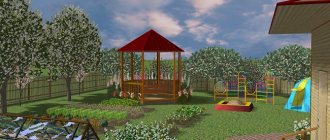
Allocating space for a recreation area
There is no uniform rule for placing a recreation area on a site. Its elements can be found in several corners of the site, or collected into a single composition in a designated area.
A gazebo entwined with picturesque clematis or other climbing plants can be a bright decoration of the area.
It’s nice to spend time in such a cozy building, hiding from the scorching sun or pouring rain.
An impressive addition to the recreation area will be flower beds, a miniature pond framed by moisture-loving plants, and neatly laid out winding paths.
Closer to the border of the site you can place a bathhouse or a swimming pool. The layout and content of the site depends only on the wishes and capabilities of its owners.
Sunny area for the garden area
The brightest and most open place on the dacha plot is allocated for the arrangement of a vegetable garden. To obtain the maximum harvest, it is advisable to think through the planting of vegetable and garden crops so that they are not shaded by the buildings of the dacha. When choosing vegetable and horticultural crops for cultivation on the site, you should take into account the conditions for their cultivation.
Some of them prefer moisture, others calmly tolerate drought; along with sun-loving representatives of the plant world, you can often find shade-tolerant specimens
Knowing these features, it is easy to give each plant its rightful place in the garden or vegetable garden, where it will feel comfortable surrounded by a pleasant neighborhood, delighting the owner with a bountiful harvest.
Article on the topic: Planning a vegetable garden and orchard: rules and nuances + examples
Rectangular plot shape
A standard rectangular plot is the most preferable option, allowing you to realize any of the owner’s ideas without resorting to special tricks.
This site layout can be applied to any rectangular area
L-shaped area
The main advantage of the configuration of the non-standard shape of the site is the isolation of the protruding part, which can be used as a niche, equipped as a cozy corner of the recreation area, hidden behind a hedge from prying eyes.
The area, limited on three sides, is conducive to a good rest away from the bustle of the city
Triangular shape of the site
A triangular-shaped plot opens up wide possibilities for arranging an asymmetrical garden, decorated with rounded elements: gazebos, lawns and ponds.
The corners of the site can protrude to accommodate utility rooms or arranging a barbecue
There is nothing complicated in planning a suburban area. The main thing is to approach this issue wisely, combining practicality with beauty in order to enjoy your stay in the lap of nature for many years to come.
- limon4ik2013
Source: https://diz-cafe.com/plan/planirovka-dachnogo-uchastka.html
Benefits of Execution
Previously, it was impossible to obtain a construction permit without a VP. Now a document is not required - private developers simply notify the local administration in writing about the fact of the upcoming construction.
However, VP is necessary . Moreover, it is precisely during the period of pre-project preparation, in order to properly plant the house vertically:
- prepare the construction site surface;
- calculate the height of the base.
Carrying out planning work after the construction of a house is irrational and economically unprofitable.
Vertical planting of the basement of a private house
Taking into account all of the above, the figure below shows an example of deepening the basement of a private house vertically into the ground. Windows are provided in the basement.
| Planting vertically in the basement of a private house. 1 - foundation slab; 2 - basement walls; 3 - window opening; 4 - leveling soil filling; 5 - blind area; 6 — storm tray; 7 - wall drainage pipes. |
Read further: How to make wall drainage around the foundation of a house to protect the basement from moisture.
More articles on this topic
- Self-learning room thermostat for gas boiler
- Roof of a private house - types, shapes, designs
- Calculation of wall heat transfer resistance
- Heating scheme with solid fuel boiler and heat storage tank
- Air humidifier for apartments and houses - which one is better to choose?
- Wooden floor on joists on the first floor of a private house
- Laying walls from aerated concrete and gas silicate blocks
- What area of premises to choose for building a house